A 3D scan can look impressive and still be wrong in important ways. A building model may lack scale. A small object may have holes. A drone survey may produce a detailed surface without reliable measurements.
The software matters, but the capture method matters just as much. Photogrammetry uses photographs to rebuild objects and places. Other scanning methods use laser light, structured light, or depth sensors.
These methods solve different problems. So, choosing software starts with understanding what you need to capture and what you plan to do with the result.
Photogrammetry, LiDAR, and 3D Scanning Are Not the Same
People often use these terms as if they mean the same thing. But they describe different ways to collect 3D information.
Photogrammetry: Rebuild a Scene From Photographs
Photogrammetry uses overlapping photographs taken from different viewpoints. Software finds matching details across the images. It then estimates camera positions and rebuilds the scene in 3D.
The process usually creates:
- A sparse point cloud showing the main scene structure.
- A dense point cloud with many more surface points.
- A 3D mesh made from connected surfaces.
- Texture maps that add color and visual detail.
- Orthophotos and elevation models for mapping projects.
Photogrammetry works well for objects, buildings, landscapes, and cultural heritage. It can also create realistic assets for games and visual effects.
But it needs clear image details. Shiny, transparent, plain, or moving objects can cause problems.
LiDAR: Measure Distance With Laser Pulses
LiDAR sends laser pulses toward objects and measures their return time. It uses these measurements to create a point cloud.
LiDAR is useful for buildings, roads, forests, and large sites. It can capture geometry even when a surface has little visible texture.
However, LiDAR equipment and processing can cost more. The final result also depends on the scanner, setup, and survey method.
Structured Light: Scan Smaller Objects With Projected Patterns
Structured-light scanners project known patterns onto an object. Cameras record how those patterns change across its surface.
The software uses this information to calculate shape. This method can capture fine details on small objects.
It is useful for product inspection, restoration, and reverse engineering. But reflective surfaces, dark materials, and outdoor lighting can affect results.
The important distinction: Photogrammetry rebuilds geometry from images. LiDAR measures distance. Structured light measures changes in projected patterns.
Some professional workflows combine these methods. For example, a team may use LiDAR for reliable site geometry and photographs for surface color.
What Makes a Good Photogrammetry Result?
A successful reconstruction begins before the software opens.
Imagine scanning an old stone statue. You walk around it and take photographs from different heights. Each photograph must overlap with nearby images.
The software looks for shared details. It uses those details to estimate where each camera stood.
This process is called Structure-from-Motion, or SfM. Next, Multi-View Stereo, or MVS, helps build denser surface information.
The quality depends on several factors:
- Image overlap: Each part should appear in several photographs.
- Sharpness: Blurry images can make feature matching harder.
- Lighting: Stable light helps reduce visual changes between images.
- Surface detail: Textured surfaces usually provide more matching points.
- Camera movement: Different viewpoints help the software understand depth.
- Scale information: Known distances or survey points help establish real measurements.
COLMAP’s official tutorial recommends strong image overlap and different viewpoints. It also warns against shiny surfaces and major lighting changes. COLMAP+1
More photographs do not always mean better results. Redundant or blurry images can increase processing time without adding useful detail.
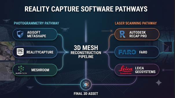
Photogrammetry Software for Different Capture Jobs
These tools cover different parts of the scanning process. Some focus on general 3D reconstruction. Others target mapping, surveying, or mobile capture.
RealityScan: Detailed Models From Photos
RealityScan is Epic Games’ photogrammetry application. It was previously known as RealityCapture.
It can create detailed 3D models and point clouds from photographs. Its workflows support object capture and larger environments.
The software also includes tools for cleanup and model inspection. Its features include image masking and quality checks that help identify incomplete areas. RealityScan+1
RealityScan suits game artists, visual effects teams, and people who need detailed real-world assets. It can also support larger reconstruction projects.
Its main consideration is the wider Epic Games workflow. Users should check installation, account, licensing, and hardware requirements before adopting it. Desktop installation uses the Epic Games launcher. RealityScan
Agisoft Metashape: From Object Scans to Survey Data
Agisoft Metashape supports aerial, close-range, and satellite imagery.
It can create dense point clouds, textured models, digital elevation models, and orthomosaics. Its Professional edition adds tools for georeferencing, ground control points, point classification, and advanced measurements.
It also supports multispectral and thermal imagery workflows. This makes it useful beyond basic object scanning. agisoft.com+1
Metashape has Standard and Professional editions. The choice matters because not every surveying feature appears in both.
For example, a hobbyist making a statue model may need only the core reconstruction workflow. A mapping team may need georeferenced outputs and ground control tools.
Check the official edition comparison before choosing a license.
3DF Zephyr: A Broad Desktop Reconstruction Workflow
3DF Zephyr handles photographs, point clouds, meshes, and several mapping outputs.
Its workflow can create 3D models, orthophotos, digital terrain models, and surface models. It also includes tools for measurements and CAD-related drawing work.
This makes it useful for architecture, archaeology, mapping, and object reconstruction. Its product range includes Free, Lite, and full editions.
The Free edition has a major limit: it supports projects with up to 50 photographs. That makes it useful for learning and small tests, but not every production job. home of 3DF Zephyr+2
3DF Zephyr also offers a wider workflow for combining photogrammetry and laser scan data. Teams should compare the edition features before planning a full project.
PIX4Dmatic: Built for Large Geospatial Projects
PIX4Dmatic focuses on aerial and terrestrial image processing.
It creates point clouds, textured meshes, digital surface models, and orthomosaics. Its workflows also support surveying outputs such as terrain models, contour lines, and CAD-ready data.
PIX4Dmatic is designed for large datasets and geospatial work. It can process aerial and ground-level images in the same broader workflow. PIX4Dmatic+1
There is an important limitation to understand. PIX4Dmatic’s documented image processing supports RGB imagery, not multispectral or thermal imagery. Teams with those needs should check other products in the PIX4D range. PIX4Dmatic
Its subscription plans differ by output and analysis features. Compare the required surveying tools before choosing a plan.
Meshroom and AliceVision: Open-Source Reconstruction
Meshroom is a node-based application built on the AliceVision framework.
It turns photographs into textured 3D models. Its node graph shows the stages of the reconstruction process. Users can also change individual steps instead of treating the pipeline as a black box.
This makes Meshroom useful for learning, research, and custom workflows. AliceVision also provides tools for camera tracking, panorama creation, and photometric stereo. 3D Computer Vision Framework
There is a hardware condition worth checking. Meshroom’s dense reconstruction stage requires a compatible NVIDIA CUDA GPU. Some tasks can use CPU processing, but that does not replace every GPU feature. GitHub
Meshroom suits users who want an open-source workflow and can manage its technical requirements.
COLMAP: A Strong Foundation for Custom Pipelines
COLMAP is a free, open-source tool for Structure-from-Motion and Multi-View Stereo.
It supports both a graphical interface and command-line workflows. It can estimate camera positions, create sparse reconstructions, and build dense point clouds and meshes.
COLMAP also offers Python bindings through PyCOLMAP. This helps developers build custom reconstruction pipelines or connect photogrammetry with other research tools. COLMAP+1
It is not a complete visual editing suite. Users may need other software for mesh cleanup, retopology, texture editing, and final presentation.
COLMAP is a good choice when control and automation matter more than a guided commercial workflow.
Polycam: Capture With a Phone or Browser
Polycam makes 3D capture accessible through mobile devices and web tools.
Its photogrammetry mode can process photographs and videos into textured models. Users can upload existing images or video for cloud processing.
Polycam also offers LiDAR-based capture on supported Apple devices. These modes serve different purposes: photogrammetry can capture fine visual detail, while LiDAR can help create quick spatial scans. Polycam Help Center+2
Its export formats depend on the capture mode and subscription plan. For example, its documented export options include formats such as OBJ, FBX, GLTF, STL, and USDZ. Some point-cloud formats require higher-tier plans. Polycam Help Center
Polycam is useful for quick object scans, room capture, and sharing models. It should not replace a controlled survey workflow when measured accuracy is essential.
Bentley iTwin Capture Engine: Reality Models for Infrastructure
iTwin Capture Engine from Bentley targets engineering and infrastructure projects.
It processes photographs and LiDAR data into reality models. Its outputs include reality meshes, point clouds, orthophotos, digital elevation models, and Gaussian splats.
It supports RGB and thermal imagery, video, and common point-cloud formats. Bentley also offers on-premises processing and connections to cloud services. iTwin Capture Engine+1
This is not simply an object-scanning application. It is designed for teams that need reality data inside wider engineering and digital-twin workflows.
Its system requirements and commercial cost are significant considerations. Bentley lists Windows-based requirements and professional hardware recommendations. iTwin Capture Engine
Comparing the Main Software Options
| Software | Main workflow | Useful outputs | Main consideration |
|---|---|---|---|
| RealityScan | Object and environment reconstruction | 3D models, point clouds | Epic Games installation and workflow |
| Metashape | Close-range and aerial photogrammetry | Meshes, point clouds, DEMs, orthomosaics | Edition differences |
| 3DF Zephyr | General photogrammetry and mapping | Meshes, orthophotos, terrain models | Free edition image limit |
| PIX4Dmatic | Drone and terrestrial mapping | Point clouds, meshes, DSMs, orthomosaics | RGB image workflow |
| Meshroom | Open-source image reconstruction | Textured meshes | CUDA requirement for dense reconstruction |
| COLMAP | SfM and MVS pipeline | Sparse and dense reconstructions | More technical workflow |
| Polycam | Mobile and cloud capture | Meshes and scan exports | Plan and capture-mode limits |
| iTwin Capture Engine | Engineering reality modeling | Meshes, point clouds, splats, DEMs | Professional hardware and cost |
These products do not all solve the same problem. A phone scanning app and a survey processing platform should not be judged by identical standards.
The Capture Method Can Matter More Than the Software
A weak photo set can defeat even a capable reconstruction engine. Good capture habits reduce missing surfaces and alignment errors.
Photograph the Subject From Different Angles
Move around the object instead of standing in one place. Capture images from different heights and distances.
Keep enough overlap between nearby photographs. Each visible area should appear in several images.
For larger objects, capture top, side, and lower viewpoints where possible. This helps reduce holes in the final model.
Keep Lighting and Focus Stable
Avoid sudden changes in light. Strong shadows can make the same surface look different across images.
Use a suitable shutter speed to avoid blur. Keep the subject still during capture.
Shiny and transparent surfaces need special care. Reflections can confuse image matching because their appearance changes with the camera position.
Include Scale and Position Information
A model built from ordinary photographs may have no reliable real-world scale.
A known reference distance can help set scale. Survey teams can use ground control points to connect the reconstruction to a coordinate system.
Ground control points are known locations visible in the images. They help establish position and support accuracy checks.
For survey work, keep some check points separate from the points used during processing. This helps assess the result independently.
Avoid Moving Subjects
People, vehicles, trees, and water can change between photographs.
These changes may create blurred or duplicated geometry. Use masking or remove unsuitable images when the software supports it.
For a moving scene, a different capture method may be more suitable.
Understand the Files Before You Export
A 3D reconstruction can produce several file types. Each serves a different purpose.
| Format | Common purpose |
|---|---|
| OBJ | 3D mesh geometry and material references |
| FBX | 3D assets for animation and interactive applications |
| GLB or GLTF | Web and real-time 3D viewing |
| PLY | Point clouds and mesh data |
| LAS or LAZ | Geospatial point-cloud exchange |
| GeoTIFF | Georeferenced imagery and elevation data |
| E57 | Exchange of 3D imaging and point-cloud data |
| STL | Surface geometry for 3D printing |
Do not assume every application supports every format. Also check whether the export keeps texture maps, coordinate information, and scale.
For example, an OBJ export may need its related material and texture files. A point cloud export may need coordinate reference information to retain its location.
PIX4Dmatic documents several geospatial and 3D output formats, including LAZ, LAS, OBJ, GeoTIFF, and other formats. PIX4Dmatic
When Photogrammetry Is the Wrong Choice
Photogrammetry is useful, but it does not fit every scanning task.
Consider another method when:
- The object has plain or featureless surfaces.
- The surface is highly reflective or transparent.
- The subject moves during capture.
- You need reliable indoor geometry in poor lighting.
- You need very fine dimensions for inspection.
- You need survey-grade results without suitable control data.
A structured-light scanner may suit small, detailed objects. LiDAR may suit large spaces and sites. A contact measurement system may be better for certain precision inspection tasks.
You can also combine methods. For example, use a laser scanner for geometry and photographs for color and texture.
How to Choose Software for Your Specific Work
The right product depends on the output you need.
- Game assets and visual effects: Consider RealityScan, Meshroom, or COLMAP. Choose based on asset quality, pipeline control, and cleanup needs.
- Archaeology and cultural heritage: Compare Metashape and 3DF Zephyr. Look closely at scale, control points, and documentation.
- Drone mapping and surveying: Consider PIX4Dmatic or Metashape Professional. Check coordinate systems, control points, and required map outputs.
- Learning and research: Start with COLMAP or Meshroom. Both offer open-source workflows and room for technical exploration.
- Quick mobile capture: Try Polycam. Confirm that its export formats fit your next application.
- Infrastructure and digital twins: Evaluate iTwin Capture Engine when your work needs engineering-focused reality data.
These are practical starting points, not fixed rankings. The best choice depends on your capture conditions and delivery requirements.
Test a Small Project Before Committing
A short pilot can reveal problems before you spend money or change your workflow.
Choose a subject that represents your normal work. Capture it with the camera or scanner you plan to use.
Then process the same dataset in the shortlisted applications. Compare the results using the same checks:
- Did the software align the images correctly?
- Are important surfaces complete?
- Does the model have the right scale?
- Are textures clean and detailed?
- Can you export the required file types?
- Can your next application open those files?
- Can your team repeat the workflow?
For survey and inspection projects, compare measurements against known reference data. A model that looks accurate may still contain scale or alignment errors.
Also record the time needed for capture, processing, cleanup, and export. Processing speed alone does not show the full cost of a project.
The Best Scan Is the One That Meets Its Purpose
A realistic model, a measurable survey, and a clean game asset are different deliverables. They need different capture methods and different software features.
Start by defining the result. Decide whether you need visual detail, accurate dimensions, geographic position, or an editable mesh.
Then choose the capture method and test the software with a real sample. Check accuracy, exports, hardware, and total workflow effort before making a long-term commitment.





Leave a Reply
You must be logged in to post a comment.